

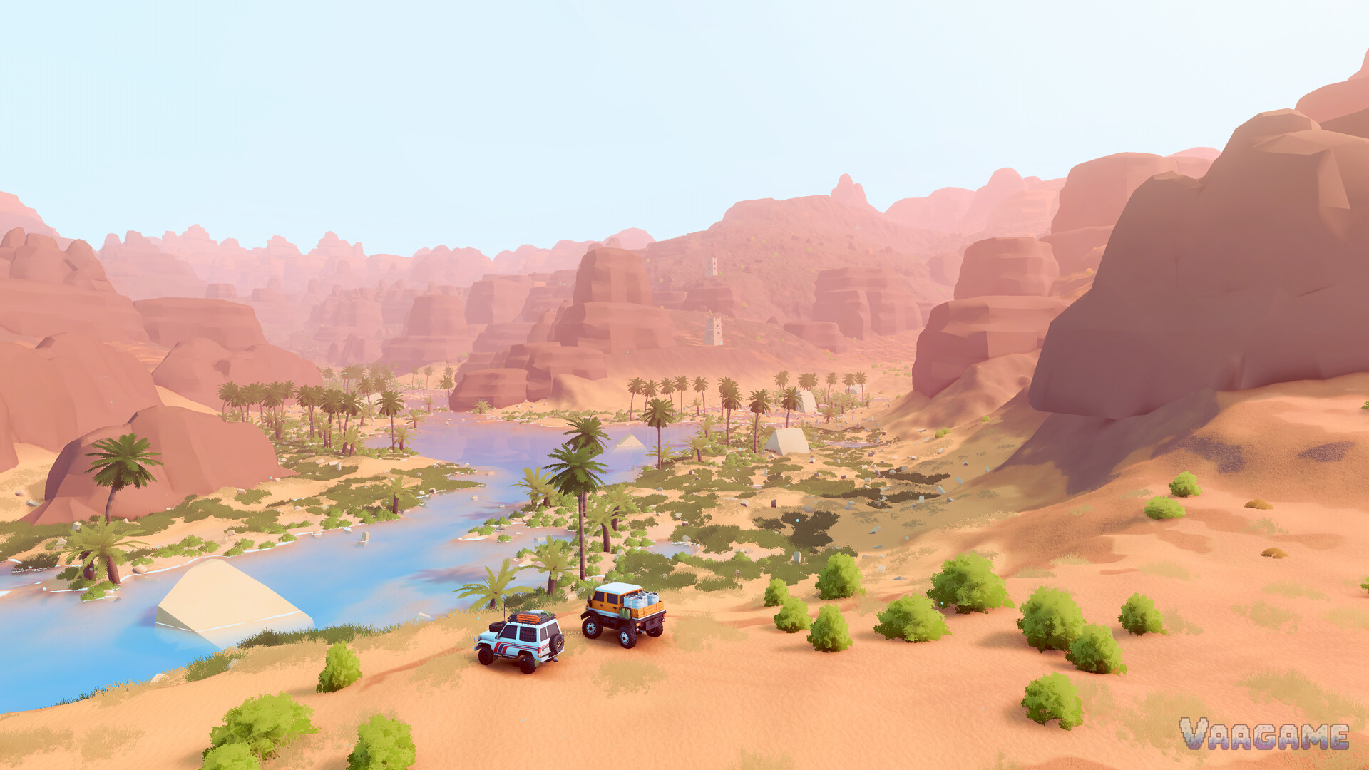
Algeria is over the hill's second region and its change of key: two desert maps of dunes, stone mesas, oases and ancient structures, where the Canadian skill set gets re-examined under sun. This guide covers when the desert opens, what changes when you get there, desert driving on sand, and — the region's signature problem — the route-finding method for viewpoints and objectives perched on top of the mesas, which launch reviewers singled out as the game's real difficulty layer.
At a glance
When: Algeria opens after your Canadian journey is under way — it is the second region, not a starter choice
The maps: Two desert areas of dunes, mesas, oases and ruins (aqueducts and arched stonework appear in the official imagery)
The signature problem: Many points of interest sit on high mesas; getting up is a three-dimensional puzzle
Sand rules: Steady momentum on dunes, low gear and patience on rock, and never trust a blind crest
Completion reality: Launch-week achievement rates for finishing the Algerian arc were a fraction of one percent — plan a campaign, not an afternoon
1. When the desert opens
The short, honest answer: after Canada. over the hill is structured as a journey that begins in the Valhallas and widens; the Algerian region unlocks as that journey progresses, and no official source published at launch states a more specific trigger — so be suspicious of any guide that names you an exact condition. What arrival feels like matters more: you step from a world you have scaffolded with cabins and camps into a bigger, emptier one where your network is thin again. The Valhallas habits — build the skeleton first, explore second — transfer directly; only the surfaces change.
When you first cross, do what you did at Emerald Lake: find the first stops, learn the surfaces at low stakes, and let the map teach its own scale before you chase the high places.
2. Two maps, one desert logic
The Algerian pair share a grammar that differs from Canada in instructive ways. Water is rarer and more precious: oases and desert rivers (both visible in the official screenshots) act as the region's anchors, the way lakeshores do in the Valhallas. Stone replaces forest as the vertical element — mesas and canyon walls divide the maps into floors, and the ancient layer sits on top of the natural one: arched aqueducts and ruined structures mark routes humans once engineered through the same terrain problem you are solving with a winch.
Navigation follows from that grammar. In Canada you read valleys; in Algeria you read levels. Every objective has a floor, and route-finding is mostly the question of how floors connect.
3. The mesa problem: how to get up there
Launch coverage (Polygon most explicitly) identified the region's core puzzle: many Algerian points of interest are placed on high mesas, and reaching them is a three-dimensional problem — the viewpoint is visible long before the route is. This is a method, and it generalises:
Circle the base before you climb anything. Mesas have a designed way up far more often than they have a heroic one. A full lap at the foot of the rock, camera up, usually reveals the ramp, the saddle or the shelf line the terrain is offering.
Look for the saddle, not the summit approach. The low point on a ridge between two heights is the natural crossing. Routes up mesas typically start at a col and traverse, rather than attacking the face beneath the objective.
Check the back side. Slopes facing away from the obvious approach are frequently the gentler ones — the long way round the rock is often the short way up it.
Follow dry water. Wadis and dry channels are the desert's roads: they cut through levels, offer firmer sand, and connect floors that cliffs separate.
Traverse in low gear, in stages. Once on a shelf line, treat it like cliff country anywhere: short stages, tilt gauge watched, winch anchored ahead on the steep pitches (the winch guide's high-anchor rule applies verbatim).
What this method refuses to do is equally important: it will not tell you "the ramp behind the third rock" for any specific mesa, because honest per-point walkthroughs need first-hand driving we are not going to fake. The method above, plus patience, solves the mesas the game intends as puzzles — that is rather the point of them.
4. Sand driving: dunes, rock and blind crests
The desert's surfaces split into two schools:
Dunes want the opposite of rock technique: a steady, committed pace that keeps the truck planing on the sand rather than digging into it, with steering kept gentle at speed. The tilt gauge still matters — a dune face is a slope like any other, and the dark wagon in the official imagery, tilted hard on a steep dune, is the region's portrait.
Rock and mesa stone want Canadian technique unchanged: low gear, chosen lines, winch discipline. Sand habits on rock will spin wheels and dig; rock habits on sand will bog you to the axles.
The desert's third hazard is blind crests: dune and ridge tops where the far side is unknown until your front wheels are over it. Crest slowly, every time. What waits beyond is as often a drop as a descent.
5. Water, ruins and the night sky
Three Algerian pleasures deserve planning rather than luck. The oases are the region's natural campsites-in-spirit — water, palms and flat ground — and the routes between them structure desert travel the way cabin chains do in Canada. The ruins — aqueducts and arched stonework standing in the sunset imagery — are landmarks and objectives both, and their engineered lines often hint at the drivable route through difficult ground: follow the old engineers.
And the night: the Algerian desert under the Milky Way is the game's postcard (it is literally one of the store screenshots), and the photography achievements reward being out in it. Plan one deliberate night drive — known ground, short distance, lamps ready — rather than letting darkness catch you mid-mesa.
FAQ
How exactly do I unlock Algeria? By progressing through the Canadian journey — the desert is the second region and opens as the Valhallas arc advances. No official launch source states a more granular condition, and we would rather tell you that than invent one.
How many maps are in Algeria? Two, against Canada's three — five areas in total at launch.
I can see a viewpoint on a mesa but cannot find the way up. What am I missing? Probably the lap. Circle the base fully, look for the saddle and the back-side slope, and follow dry channels between levels. The face under the viewpoint is almost never the route.
Is Algeria harder than Canada? Differently hard. Sand technique and vertical route-finding replace Canada's water and weather pressure, and the completion data agrees it is the long game: in launch week, well under one percent of players had finished the Algerian arc.
Does my Canadian progress and vehicle carry over? Yes — it is one journey and one fleet. You arrive in the desert with your vehicles, upgrades and kit intact; only the local cabin and camp network starts thin again.
Related guides
over the hill Valhallas Guide: Emerald Lake, Gimli Ridge and Asgard Mountain Routes
over the hill Driving Guide: Gears, Terrain Reading and Vehicle Control
over the hill Winch Guide: Self-Recovery, Anchor Points and Getting Unstuck
over the hill Meteorites and Pebbles Guide: Finding, Hauling and Spending the Currency